Memorial Park in Port Credit is one of Mississauga’s great outdoor spaces.
Located on the east bank of the Credit River, just north of Lakeshore Road, the Park has green spaces, a stage, the city’s Music Walk of Fame – and a deep connection to the Mississaugas of the Credit.
The land along the Credit River was long part of the Mississaugas’ traditional territory, which extended over much of today’s Golden Horseshoe. However, the area at the mouth of the Credit River holds particular significance in the history of the Mississaugas—and in the city that bears their name.
Specifically, Port Credit Harbour owes its existence to the Mississauga’s initial financial investment.
In 1828, the Mississaugas bought a two-thirds majority share in the Port Credit Harbour Company, the first harbour in Toronto Township.
It proved to be an important investment.
By this time, British and American settlers had been building and clearing the land around the Credit River for over two decades, which included the establishment of a number of grist (flour) mills and sawmills in what would become Erindale and Streetsville.
Lumber and flour from the mills, along with fruits and vegetables from farms, were shipped from Port Credit Harbour to American markets – and the Mississaugas were at the centre of Port Credit’s early colonial trading venture.
They built the wharves for the new harbour, one of which extended 300 feet and which was wide enough for horse-drawn wagons to haul grain to waiting boats.
At the height of the harvest season, it was said that two steamships left each day, ladened with goods.
The Mississaugas also built and operated one of the schooners, the Credit Chief, that worked Lake Ontario’s trade routes, following in the wake of centuries of Indigenous trade through the Great Lakes.
A few kilometres north, where the river bends at what is now the Mississauga Golf and Country Club, the Mississaugas lived in what remained of their original lands.
Although the Credit Mission, as it was known, occupied just a few hundred acres on land ceded to the Crown, there is evidence that the Mississaugas developed a far larger area.
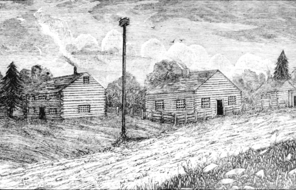
A sketch of a typical Mississaugas home at the Credit Mission in the early 1800s. (Photo credit: Heritage Mississauga)
There are historic accounts that the Mississaugas lived and farmed on over 3,500 acres, roughly a mile on either side of the Credit River from the mouth of the river, basically where the QEW bridge is today, to today’s Queensway.
Here the Mississaugas built about 40 homes, a hospital, a school, a blacksmith shop, eight barns and two sawmills. They reserved about 900 acres for farming and pastures where they grew, potatoes, corn, peas, oats and wheat. They maintained several orchards and raised cows, pigs and chicken.
All this economic activity was driven in part by Rev. Peter Jones (Kahkewaquonaby), the biracial son of Tuhbenahneequay, daughter of a former Mississauga chief, and British surveyor Augustus Jones.
Peter and his brother John (Thayendanegea) were raised by their mother until their early teens, when they went to live with their father to complete their schooling, and where Peter was ordained a Methodist minister.
Rev. Jones believed that economic freedom was the path to survival for the Mississaugas and he advocated for that at all levels of government – including a private audience with a young Queen Victoria at Windsor Castle.
He was assisted in his efforts by his brother John, and John’s wife Christiana, granddaughter of Mohawk military leader Joseph Brant – the most famous and powerful Indigenous leader of his era.
The Jones brothers influenced the development of both the Credit Mission and the settler community at the mouth of the river.
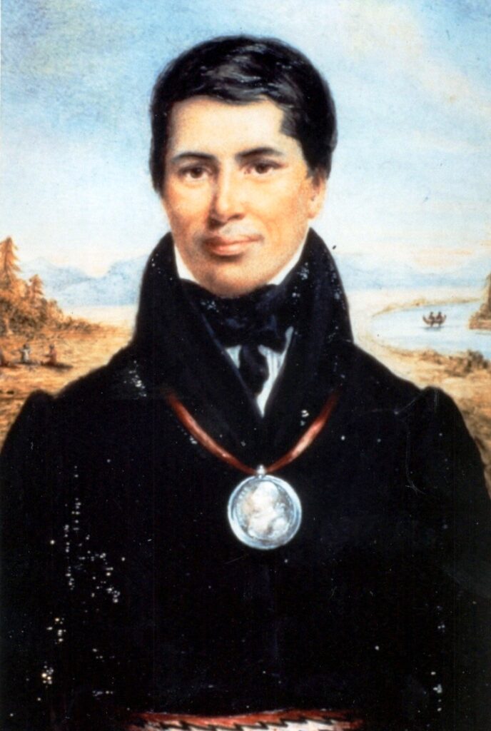
A portrait of Reverent Peter Jones (Kahkewaquonaby) the biracial son of a Mississaugas woman and British surveyor who was influential in establishing the Mississaugas’ economic interests. (Photo credit: Heritage Mississauga)
In 1828 they, along with Mississauga Chief Joseph Sawyer, were three of the original 10 charter members of the Port Credit Harbour Company, and it is possible they influenced the design of the original lots that created the Village of Port Credit in 1834.
Both brothers each received 1.5 acre lots along Port Street and Peter and John Streets are named in their honour.
However, despite the Mississaugas’ economic success and the Jones’ political advocacy, the community did not feel safe on their land, most notably because they were unable to secure title to their land from the colonial government of Upper Canada, then led by Sir Francis Bond Head.
In 1846, the colonial government unilaterally ordered the Credit Mission lands be surveyed and prepared for settlement.
The Mississaugas needed to find a new home, and in 1847 the Mississaugas acquired 6,000 acres in their traditional territory from the Six Nations, home to the Haudenosaunee.
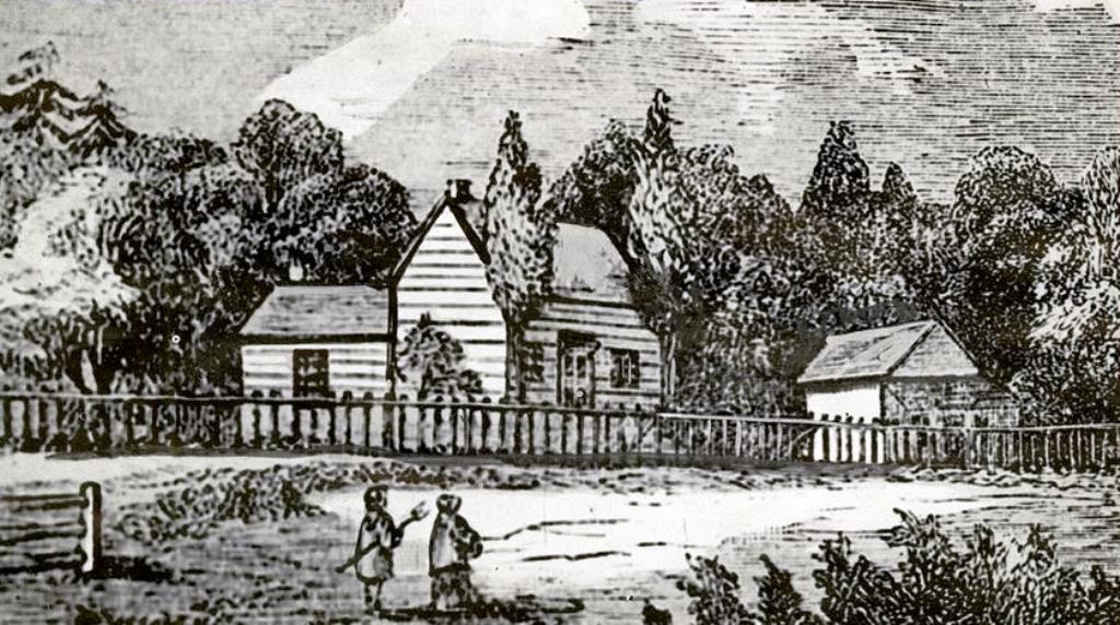
A sketch of the Credit Mission’s Methodist Church where Rev. Peter Jones and others preached. The Church and the Mission were located on the current site of the Mississauga Golf and Country Club. (Photo credit: Heritage Mississauga)
In May 1847, about 250 people left the Credit River for the Grand River and established a new Reserve near Hagersville, Ontario.
In 1903 the Mississaugas of the Credit purchased the land from the Six Nations and today, the Mississaugas of the Credit First Nation is a community composed of approximately 2,700 members. One-third of the community lives on reserve lands while the others mostly live in the Greater Golden Horseshoe Area.
You can hear more about the Mississaugas of the Credit and other stories about the people and events that helped shape Mississauga via our podcast, We Built This City: Tales of Mississauga, available on your favourite podcast platform or from our website
Have your own story to share? We’d love to here it! Click here to submit your story.