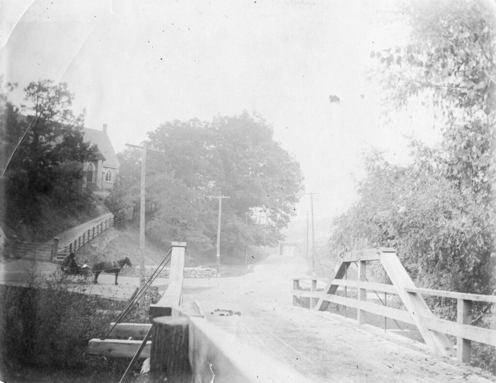
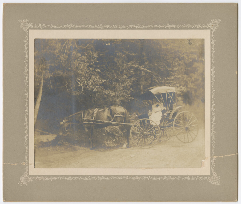
Mississauga’s major roadways tend to run as straight as rulers, except for one: Mississauga Road.
Ending on the shores of Lake Ontario, Mississauga Road follows a more natural trajectory along the west side of the Credit River because, unlike all the other major thoroughfares that crisscross the city, Mississauga Road has a much older story to tell.
A story about the land and the people who have lived here continuously for over 10,000 years: the Mississaugas of the Credit.
The road that now bears their name is their former trail, which the Mississaugas used to move with the seasons.
The road that now bears their name is their former trail, which the Mississaugas used to move with the seasons.
They travelled down to the mouth the Credit River, or Missinnihe as it was known to the Mississaugas, where they would fish during the spring and autumn salmon runs, and in summer gather wild rice and harvest corn on the river flats.
Then they’d follow their well-travelled route north to spend the winter inland, away from the bitter cold of Lake Ontario.
When the French traders arrived in the 1700s, they would meet and trade with the Mississaugas at the mouth of the river, supplying goods in advance, or on credit, against furs that would be delivered the following spring.
That’s why the French called it the Rivière au Crédit, and when the British began to colonize the area in the early 1800s they anglicized the name to the Credit River.
The Credit River flows through the heart of Mississauga both in terms of its geography and its history.
Starting at its headwaters about the Niagara Escarpment near Orangeville and Caledon East, it drains an area of approximately 1,000 square kilometres (390 sq mi) to empty into Lake Ontario in Port Credit.
Even today, as the City of Mississauga has grown up around it, most of the Credit River, can still be travelled by canoe or kayak, and the lower section that flows through the city provides spawning areas for Chinook salmon and rainbow trout.
The Credit Valley Conservation Authority honours both Mississauga Road’s and the Credit River’s Indigenous origins with the Credit Valley Trail, which when completed, will be a 100-kilometre path that travels the length of the Credit River Valley, connecting Mississauga the other communities in the watershed – Caledon, Halton Hills and Brampton – that reside with the traditional territory of the Mississaugas.
Currently, you can traverse part of the trail via the David Culham Trail, which extends from Dundas Street to Streetsville, and a second section from Church Street to Velebit Court in Meadowvale. The trail follows the river parallel to Mississauga Road with connections to the University of Toronto Mississauga, Erindale Park, Streetsville Memorial Park and Riverwood Community Centre, the latter a 150-acre natural area.
The Mississaugas of the Credit remain active stewards of their Treaty lands and territory, promoting the wise use of lands, waters, and resources so the next seven generations, Indigenous and non-Indigenous alike might enjoy the land they share.
This includes developing dedicated spaces along the Credit Valley Trail that recognizes and honours Indigenous knowledge, history and present-day culture.
Elder Carolyn King, former chief of the Mississaugas of the Credit, has been a long-time advocate for developing strong relationships between the Mississaugas and the city that bears their name.
One of her many projects is the Moccasin Identifier Project. Working with Indigenous artist Philip Cote, four moccasin designed stencils – representing the Anishinaabe, the Huron Wendat, the Seneca and the Cree – have been created.
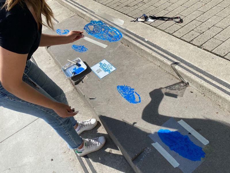
Since 2021, the Moccasin Identifier Project has installed these stencilled images at culturally significant sites across the GTA, including along Lakeshore Road in Mississauga and the entrance to the Credit Valley Conservation offices, to help promote the region’s diverse Indigenous cultures and the strong ties Indigenous Communities have to the land.
To date, the project has visited over 1,000 schools, universities, workshops, major events, opening ceremonies, and celebrations.
The vision is to cover Canada in moccasins, so no matter where we travel, be it along straight roads or those that curve along the river’s edge, we may all be reminded of those who have walked the land for thousands of years and gave this city and the road that runs through it, its name.
June is National Indigenous History Month and the City of Mississauga is honouring celebrating in a variety of ways throughout the month. Visit the City’s National Indigenous History Month webpage to learn more and join us at special events around the city.
Have your own story to share? We’d love to here it! Click here to submit your story.
Lorne Joyce, a long-time resident of Port Credit and local history buff, once told me that the original alignment of Mississauga Rd in the CN tracks was different from what it is today. He said it went up what is now Wesley Ave. and Kane Rd up to Indian Rd. The alignment was changed when the railway bridge was built.